Roads We’ve Travelled – 1

There’s no shortage of variety of roads to travel in this wide brown land, so I thought I’d show you a few along the way from the co-pilot’s seat here in the super-cruiser.
First up – the Oodnadatta Track. Really a dirt road with a good surface – although I’ve never been there after a drop of rain.

Next up, it’s the road from William Creek, where we left the Oodnadatta Track, through to Coober Pedy. Spot the tree.

And the last Road in this Post is the good old Stuart Highway. Some bitumen to break things up.

Next set of Roads may be a while away – all depends on internet! – but I have some more up my sleeve.

Red Bank Gorge Explorers, July 5, 2013

It’s about 20 minutes’ walk into the actual gorge along the dry and rocky riverbed, with towering red cliffs on either side of you, and ghost gums clinging to the sides of the gorge.
The boys donned their winter wetsuits.
IMG_3186 Red Bank Gorge (1280x853)
And disappeared off into the gorge.
IMG_3188 (1280x853)
The water was freezing. There’s no way you could swim here without a wetsuit.

They paddled up a tall narrow gorge with deep red/purple walls, brushed smooth by the eddies during floods. The gorge narrowed to an arm’s span in width and involved up to 300m paddles on the surf boards. They then scrambled over logs, boulders and chock stones to reach the far side of the West MacDonnells Ranges. The total length of the gorge was probably only 500m, but felt much longer. The journey involved rope climbs, swimming, board paddling and vertical jumps on the return journey.

And the final wrap:

Surfing in Central Australia? July 5, 2013

We took a new road (not on our 25 year old maps) from Kings Canyon that connects with the far end of the West MacDonnells. It’s a rough unsealed road that runs parallel to the Gardiner Range. The sweeping curves were very reminiscent of the Flinders Ranges. Quite spectacular.
On the way we stopped to look at Gosse Bluff or Tnorala. It’s a huge (5km across) crater left by a meteorite (actually it could have been a comet) some 140 million years ago. We drove right into the centre of the crater.
IMG_3178 Goss Bluff (1280x853)
Above is the view of Gosse Bluff from Tyler Pass.
Arriving at Red Bank Gorge for a late lunch, we are camped on the ridge top looking down at the start of the Gorge walk. And this is where the surf boards and wetsuits come in handy – for a walk in the gorge, of course. Want to come too Will?
IMG_3180 Red Bank Gorge (1280x853)

No Fun Police Here! July 4, 2013

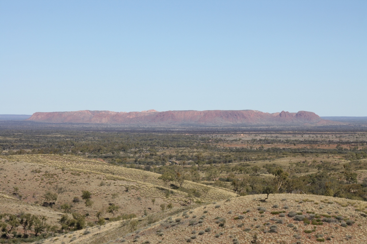
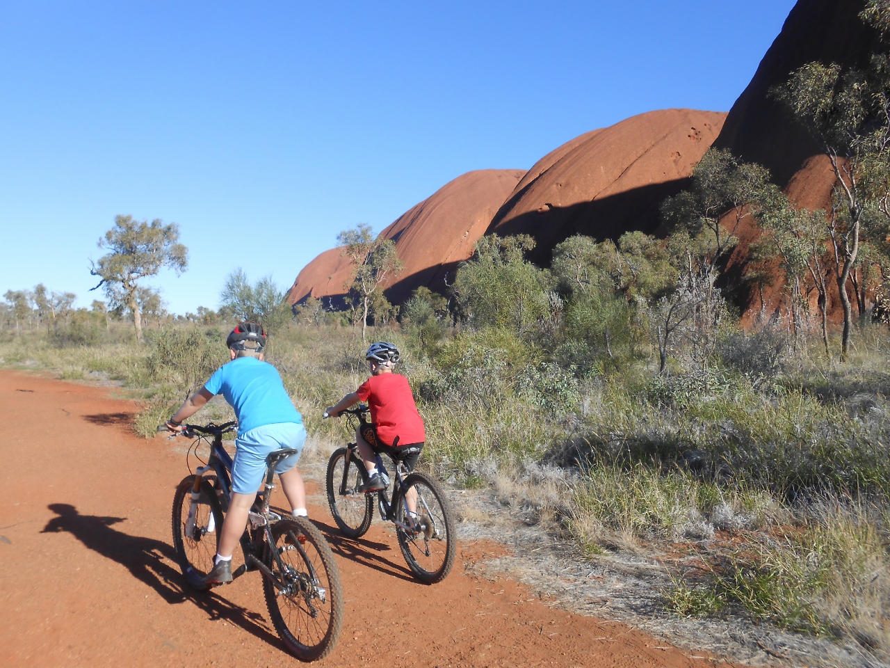
We left the beauty of The Rock, and headed east back to the turnoff for Kings Canyon. The trees in this whole area are mainly Sheoaks, but not mop-top shaped. They are more like tall columns of foliage, and there’s little undergrowth. I’m doing a series of videos of our scenery to put up – but haven’t come across enough power and reception simultaneously – yet.
Moving on – Kings Canyon.
Truly stunning. (I’m sure I’ll run out of superlatives soon).
IMG_3158 (1280x853)
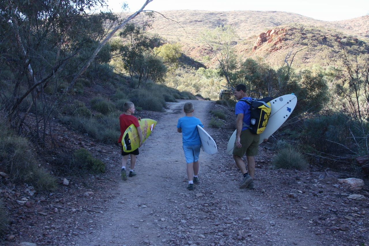
We started the 6km walk around the rim about 3.30pm, so the afternoon sun light made for some great photos.
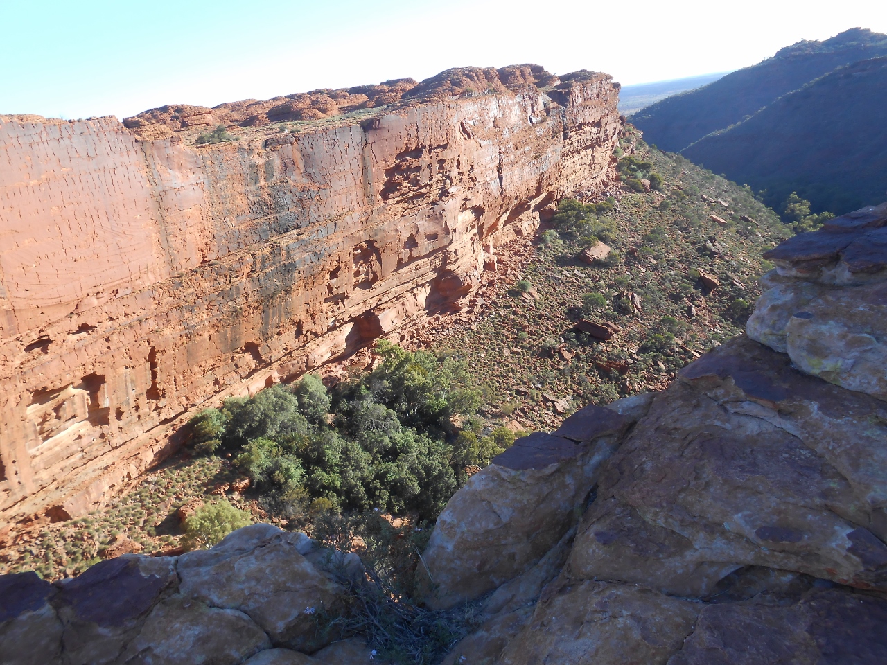
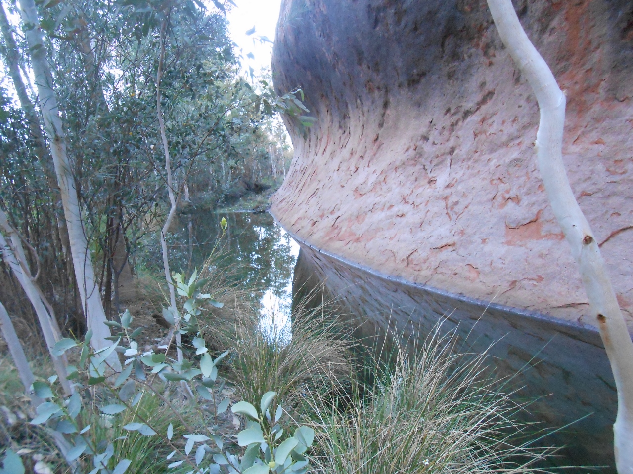
This area was only declared as Watarrka National Park in 1989. The gorge itself is about 1km long, and at the end is the lush Garden of Eden, where heaps of different plants (including the ancient Cycads) enjoy the moisture and cool at the foot of the cliffs.
DSCN2870 (1280x960)
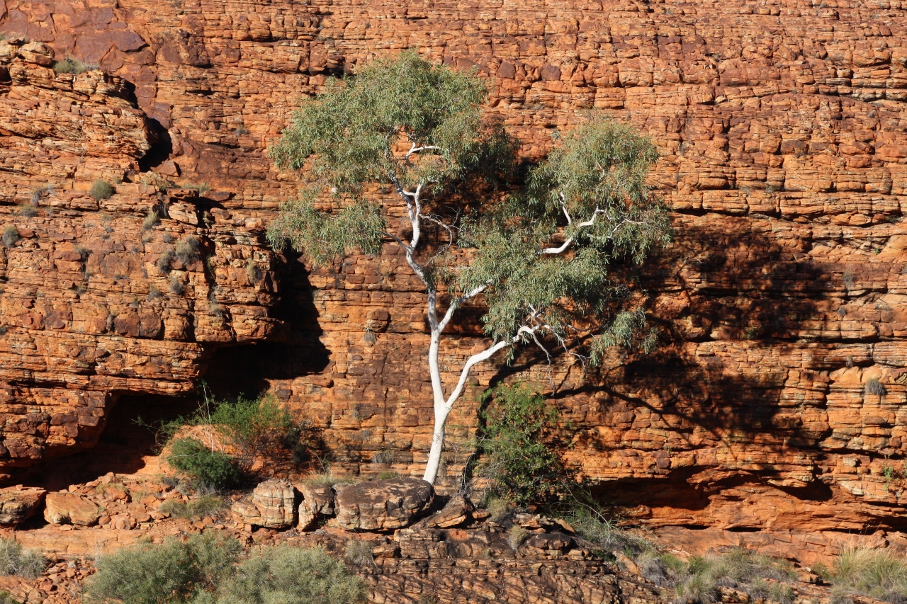
Fergus took this great shot:
DSCN2864 (1280x960)
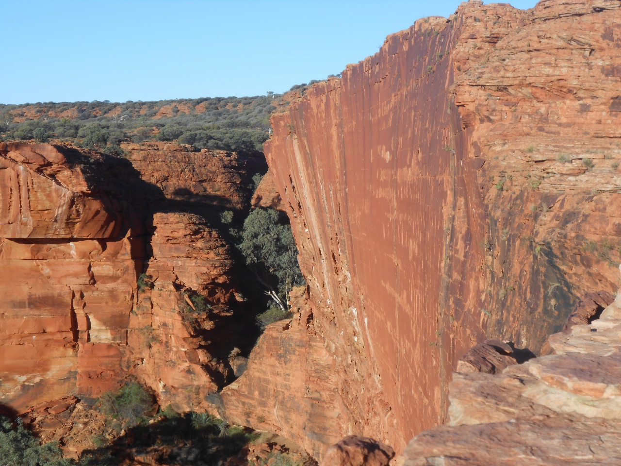
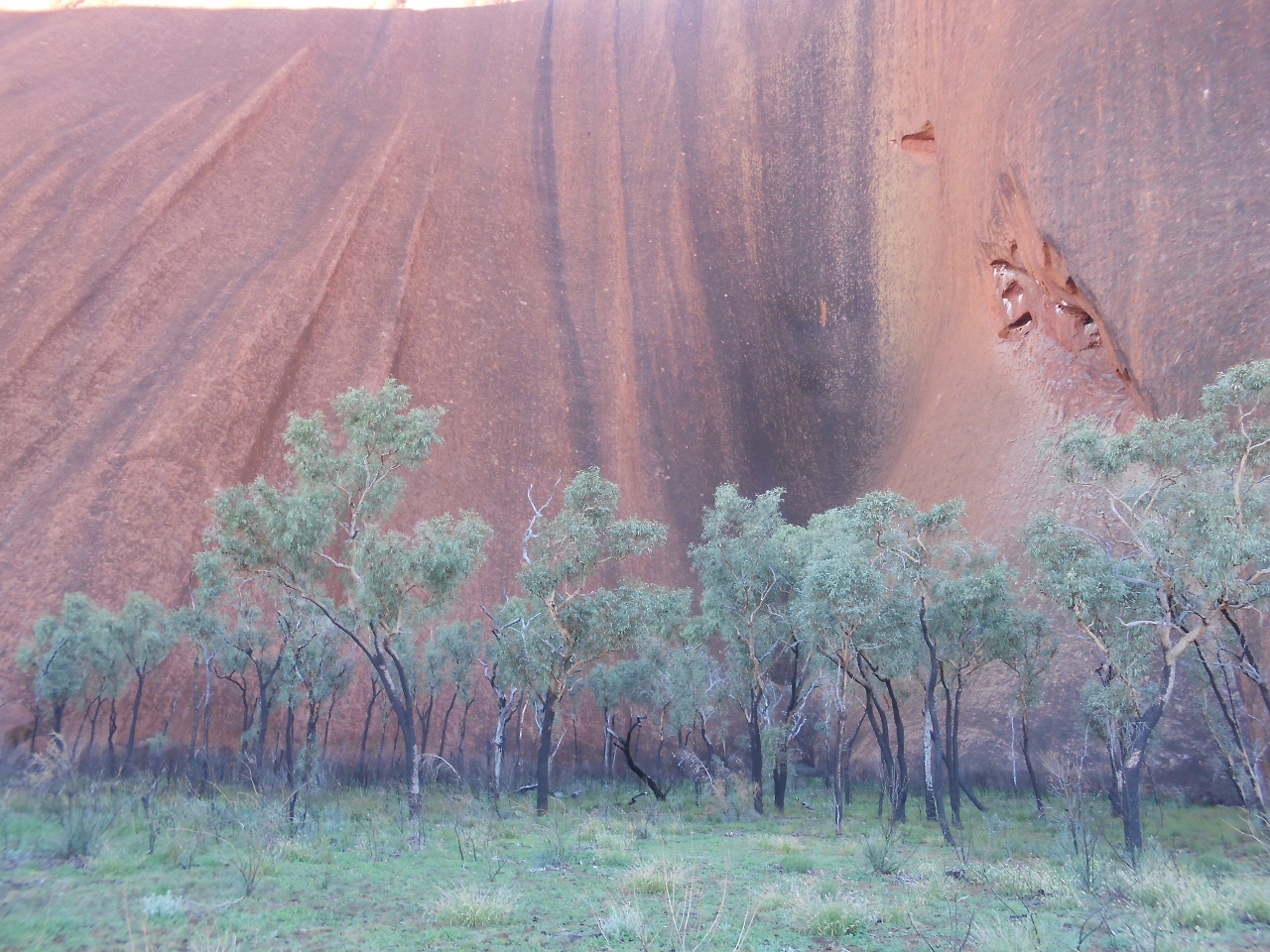
The red and orange of the sandstone cliffs certainly rivals Uluru in the late afternoon sun.
DSCN2968 (1280x960)
Now there’s two things I really don’t like. Crowds and cliff edges. I can’t say Kings Canyon was crowded, but it certainly tested me on the cliff thing because there’s a whole lot of unprotected cliff edges. The Fun Police have left the public to their own devices!
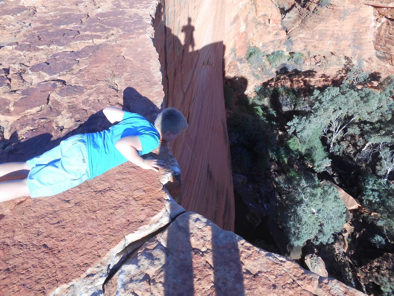
Here’s Ferg taking a peak and making my stomach churn.
DSCN2858 (1280x960)
And watch this video for more alarming stuff!

And Harry made an equally harrowing video. At least he said it was scary.

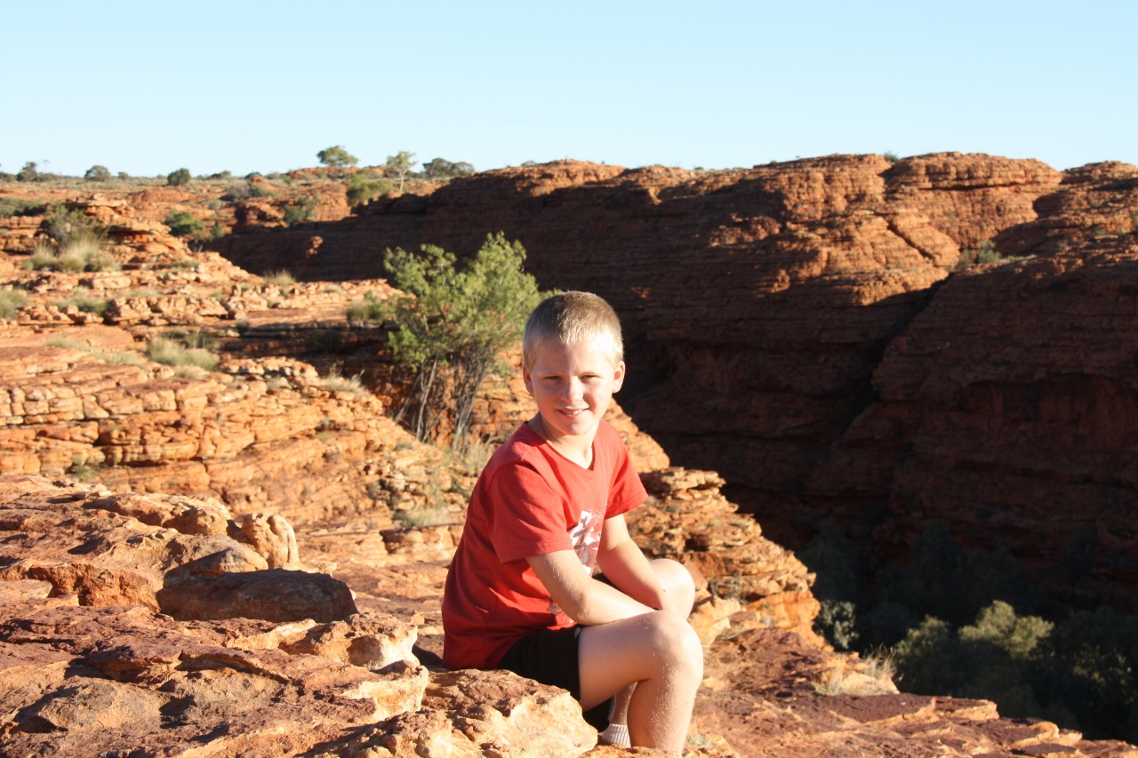
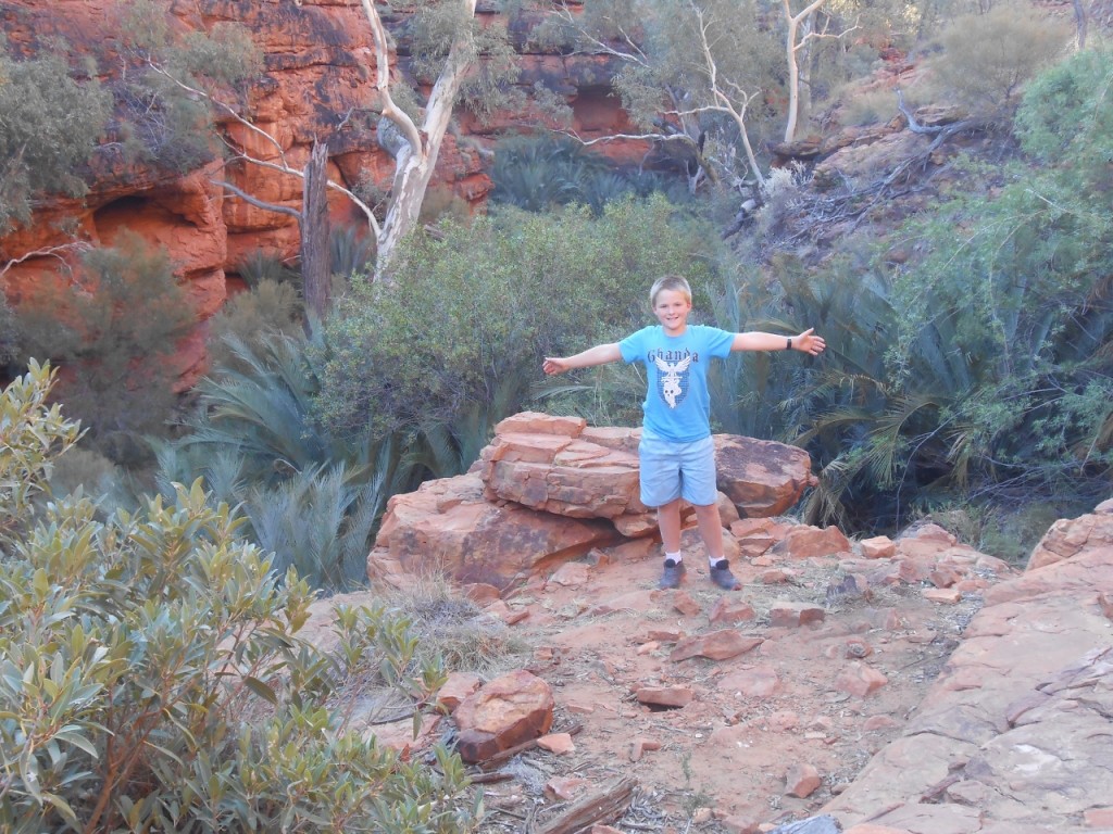
Occasionally, I managed to keep the boys away from the edge for a nice photo. Here’s Harry, pretending to be an angel.
IMG_3163 (1280x853)
Once we got round to the other side, the boys really sent me into a spin. First, I’ll show you this.
IMG_3171 (1280x853)
And now this is where they were “in the scheme of things”.
IMG_3172 (853x1280)
Now, will some other mothers out there please tell that I’m not being unreasonable about this edge thing? Comments please.
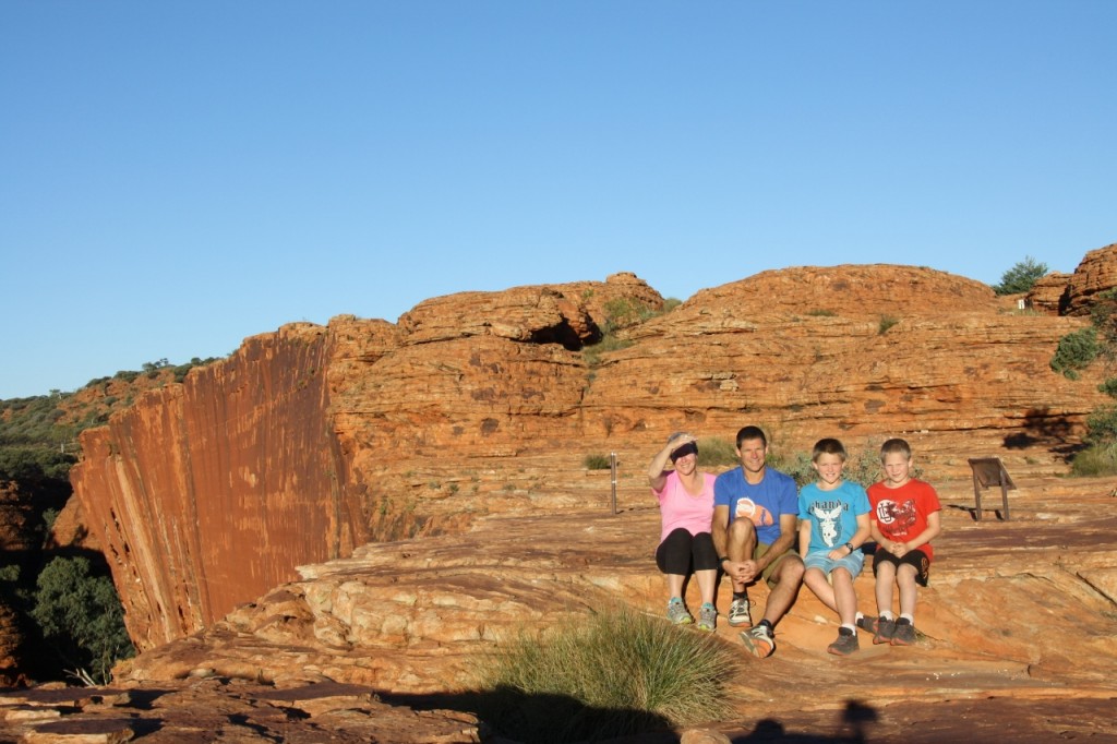
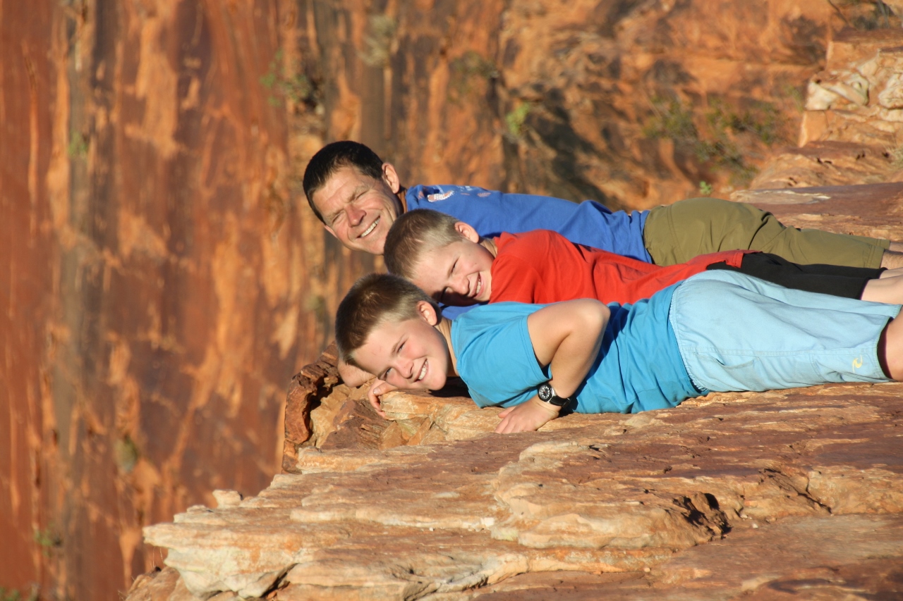
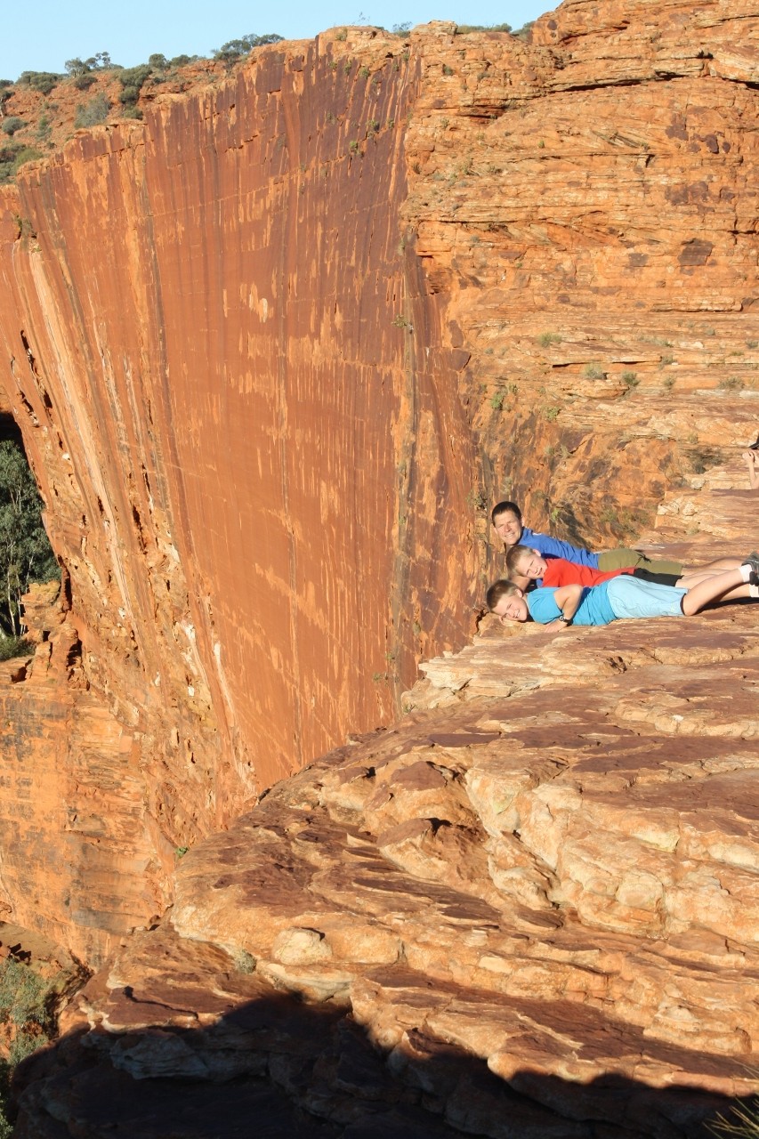
And I’ll just add one last photo – mini tripod assisted – the family shot. I didn’t quite realise I’d be looking straight into the sun when I set it up!
IMG_3174 (1280x853)

Rocking and Rolling, July 4, 2013

That would be Rolling round the Rock on bikes! After John had a spin round the circuit walking track the other morning on his bike, he found that the Fun Police have realigned the track to be quite distant from the Rock around the north-east side. We know this because John has brought with us many maps from previous trips! So the 1987 map tells the tale of how it used to be.
To avoid the boring bit, John dropped the rest of us at one point with the bikes, and drove the car back to the car park and ran round to meet us.
DSCN2828 (1280x960)
John’s bike riding mates reading this will see that Ferg has stepped up to John’s bike (the seat won’t go any lower!), Harry moved up to Ferg’s bike, and I got MY bike back from Harry. It sure was better riding 6km than walking. Now Ferg wants a carbon fibre bike too.
You get up close and personal with the rock wall. There are numerous caves, amazing rock formations, aboriginal paintings on the walls and some permanent water pools.
DSCN2838 (1280x960)
It was a perfect morning, still a bit chilly in the shade, and no wind.
DSCN2829 (1280x960)
I took a moment to rest my weary knees on one of these handmade timber seats.
DSCN2825 (1280x960)